The Baltic Sea anomaly — the echo and the reading of the echo
In June 2011, a Swedish team searching for shipwrecks ran a sonar over the floor of the Gulf of Bothnia and came back with a round blot sixty meters across. No one else has seen the raw image, the position was never disclosed, and what came up from the bottom was stones. Fifteen years later, in October 2026, the blot still yields more headlines than data.
- Where
- Gulf of Bothnia, between Sweden and Finland
- Exact position
- not disclosed
- Record
- side-scan sonar, June 2011
- Depth
- ≈ 85 – 91 m
- Diameter
- ≈ 60 m
- Scientific publication
- none as of October 2026
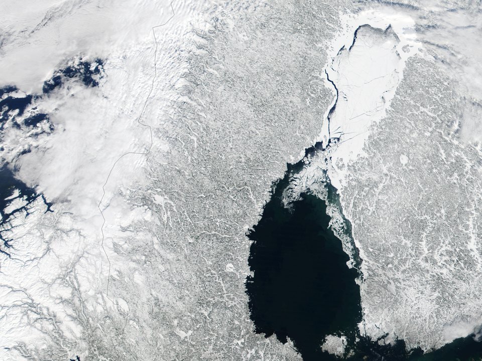
The Gulf of Bothnia is the northernmost arm of the Baltic Sea, a long, shallow basin squeezed between the Swedish and Finnish coasts, its water nearly fresh, freezing in winter. Beneath it lies the ancient rock of the Scandinavian shield, covered by what the ice left behind as it retreated: gravel, clay, moraines and loose boulders the size of houses. It is a seabed full of strange shapes, and almost all of them have the same author.
In June 2011, a boat belonging to the Ocean X Team was surveying that seabed with a side-scan sonar. The team, led by the divers Peter Lindberg and Dennis Åsberg, made its living finding shipwrecks — Lindberg was known in Sweden for having located, in 1997, the wreck of the Jönköping, a schooner sunk in 1916 with bottles of champagne that came back to the surface still drinkable. That summer the target was another ship with a valuable cargo. On the 19th, the sonar screen showed something that did not look like any ship.
01What the sonar showed
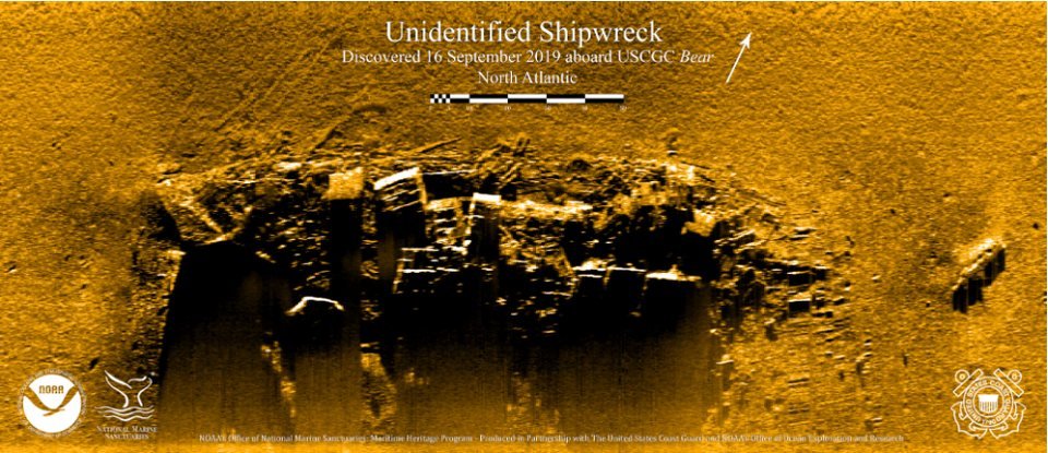
The image Ocean X released that summer shows, on a grainy background, an almost circular shape about sixty meters across, with a bright outline on one side and a shadow on the other. Leading out of it is a long, straight band the team called a "track," as if something had slid along the bottom before stopping. About two hundred meters away, they said, the same sonar had picked up a second shape — but that second image was never released because, in Lindberg's own words, it had come out too blurry.
For months the story circulated on forums and mystery sites, but it was the tabloids, in 2012, that turned it into world news. Some reproductions redrew the outline of the blot, sharpening edges and symmetries that the original image does not have, and the comparison with a science-fiction spaceship did the rest. From then on, the shape came to be described in more detail than the sonar ever recorded.
02How to read a side-scan sonar image
A side-scan sonar is a cylinder towed on a cable a few meters above the seabed. It fires pulses of sound to both sides and records the echo that comes back. A hard surface tilted toward the device returns a lot of sound and appears bright; whatever lies behind a raised feature receives no sound at all and appears dark — this is the "acoustic shadow," which gives the image the look of a photograph taken in raking light. Except it is not a photograph: it is a graph of the echo's return time, drawn line by line as the boat moves forward.
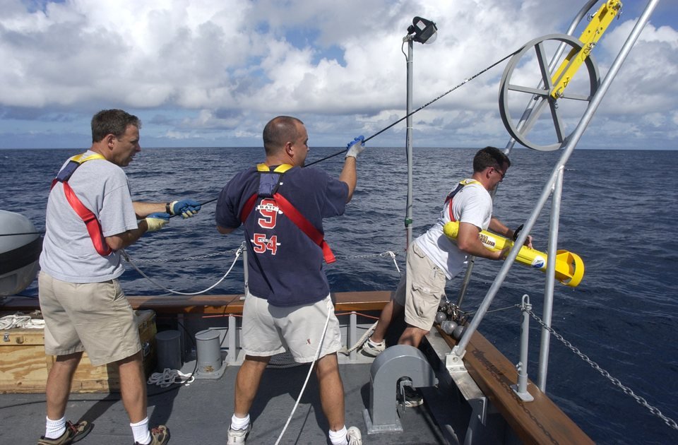
That is why the image distorts in predictable ways. If the fish sways, rises or turns, straight lines appear crooked and round shapes become ovals. If the boat's speed changes, the image stretches or shrinks along the direction of travel. And if the device's two channels, left and right, interfere with each other, a target on one side leaves a "ghost" on the other. Straight bands on the seabed can be sediment ripples, layers of exposed rock — or simply processing defects.
That was the point made by the engineer Hanumant Singh, then at the Woods Hole Oceanographic Institution, in the United States, who examined the image at the request of the press. He pointed out in the Ocean X image signs of a mirrored reflection of the circular shape in the opposite channel — crosstalk between channels, typical of a badly connected device — and noted that side-scan sonar works well for tall wrecks with sharp shadows and poorly for low, rounded features. His conclusion was that, with those distortions, the image was of very little use in saying what was on the bottom. Charles Paull, of the Monterey Bay Aquarium Research Institute, found the story curious and entertaining, but without substance: nothing in the image called for more than a natural formation.
03Returning to the site: what the divers described
In June 2012, the team spent about twelve days over the site, with sonar, a camera on a remotely operated vehicle and divers. The photos and videos from that campaign show a dark seabed with short visibility, stone surfaces, cracks filled with black material, a cluster of rounded stones the team compared to a fireplace, and steps it described as "stairs." The shape, according to them, rises a few meters off the bottom; the figure varies between interviews, from three to four meters up to a supposed pillar of eight.
Two accounts from the same season weighed more in the press than the photographs. A team diver said the electrical devices on board, including the satellite phone, stopped working when the boat was over the shape and came back on about two hundred meters away. And Lindberg himself, at the end of the campaign, said the thing resembled a giant stone, of the kind divers see in harbors — only to joke immediately afterward that no one said aliens had to use metal.
None of these accounts was measured in a way that someone else could check: there is no published record of the failures, with time, device and position, nor any topographic survey of the object with scale. What the 2012 campaign produced that can be verified was stones.
04What the stones said
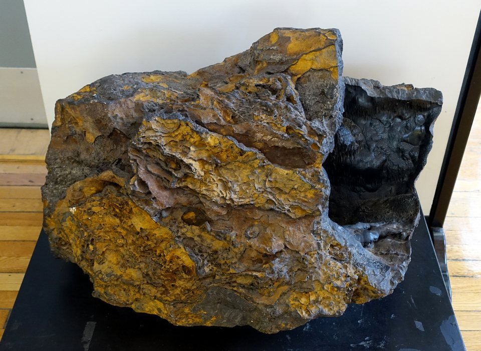
The divers brought back fragments from the site, and they passed through more than one pair of hands. The geologist Volker Brüchert, an associate professor at Stockholm University, examined the samples the team gave him and, in August 2012, summed them up for the press: most were granite, gneiss and sandstone — exactly the repertoire of a basin that was covered by glaciers. There was also a loose piece of basaltic rock, of volcanic origin. For Brüchert, none of this was strange: on a seabed where the ice dragged rocks from all over Scandinavia, an out-of-place block of basalt is to be expected, and the feature and the stones probably formed through glacial and postglacial processes.
Another part of the material went to Israel. According to what the team and the Swedish press released, Steve Weiner, then director of the archaeological science center at the Weizmann Institute, analyzed a chip by infrared spectroscopy and identified limonite and goethite — iron oxides and hydroxides, the same material as rust. In the version that reached the newspapers, Weiner reportedly found it strange to find these minerals in a structure like that, which would be more reminiscent of a modern construction. We did not locate a technical report signed by him; what circulates is the relayed statement.
It was this statement that turned, on mystery sites, into the claim that the object contained metals that nature does not produce. The claim does not hold up even as a summary. Limonite and goethite are not metals, and they are extremely common minerals — limonite is the "bog iron" that Nordic peoples used as iron ore for centuries. The geologist Fredrik Klingberg, of the Geological Survey of Sweden, and the marine geologist Martin Jakobsson, of Stockholm University, responded that the composition resembled that of the iron nodules and crusts that form naturally on the seabed, and that limonite and goethite precipitate there through the chemistry of the water, without any human intervention. Jakobsson read the material as sandstone.
05The gulf the ice carved
Until about ten thousand years ago, the Gulf of Bothnia lay beneath the Scandinavian ice sheet, more than two kilometers thick at its center. As it advanced and retreated, that ice scraped the bedrock, carried pieces of it for hundreds of kilometers and dropped them where it melted. That is why the floor of the gulf is strewn with erratic boulders, moraine ridges, elongated hills called drumlins and boulder fields — shapes that, seen from above, can be surprisingly regular.
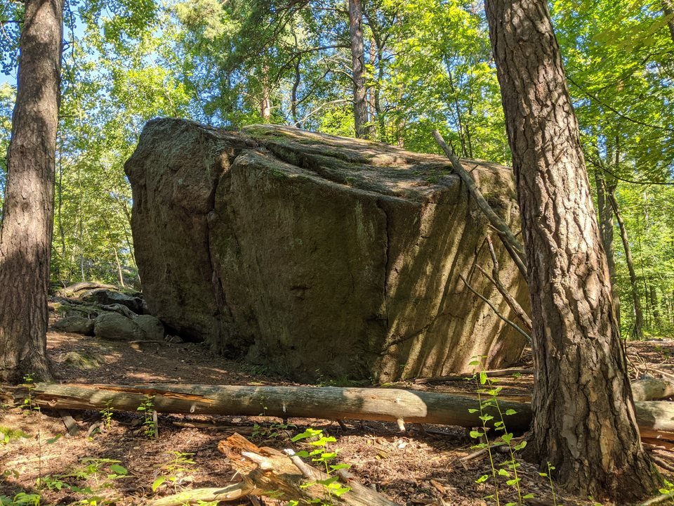
The geologists who commented on the case did not all bet on the same form. Brüchert spoke of a glacial deposit. The Finnish geomorphologist Jarmo Korteniemi noted that the straight "track" looks like a drumlin or a moraine ridge, both common in the region. It was also pointed out that rounded mounds on the seabed form where fluids and gases escape from the sediment and cement the surrounding rock. In the American press there was talk of pillow basalt, the form lava takes when it cools underwater — a reading no sample confirmed, since the only basalt collected was a loose stone. What these readings have in common is that none of them needs anything beyond what is already known about the Baltic seabed.
There is one consequence worth keeping in mind. An erratic boulder or a moraine mound does not grow out of the bedrock: it was placed on top of the sediment. This will matter further on.
06Discovered yesterday: the 2025 expedition and what is still missing
After years without a new campaign, the anomaly returned to the news in February 2025, when Dennis Åsberg gave an interview to the Australian journalist Ross Coulthart, of the American network NewsNation, known for his coverage of unidentified aerial phenomena. Åsberg described a round object that "looks like it's separated from the bottom," with angles, holes and a track about one thousand five hundred meters long — almost four times the length cited in 2012.
In July 2025, the Society for UAP Studies, an American association devoted to the study of these phenomena, announced support for an expedition funded by a targeted donation. It was not leading the mission; it said it was handling protocol, advisory work and communications. In the first phase, according to the press releases, the team used multibeam sonar, a sub-bottom profiler, three-dimensional modeling by photogrammetry and environmental sensors, with the participation of a robotics company, a French group and the astronomer Beatriz Villarroel, of Stockholm, known for searching for artificial objects on old photographic plates of the sky. Åsberg said he had received data so incredible that he was "at a loss for words" and announced a paper with Villarroel, with no date.
What has come out since then are statements and snippets. The sub-bottom profiler, according to the team, shows that the object rests on a layer of sediment and does not rise out of the bedrock. Interviews and reports in November 2025 also brought descriptions of "straight walls" and "ninety-degree corridors," of periodic outflows of murky water through a hole and of a local drop in temperature. On January 9, 2026, Åsberg posted on social media two multibeam sonar images from the 2025 campaign, saying they were a small part of the data, that the investigation was continuing and that he would not release more at that time. The team spoke of a new campaign in the summer of 2026 and of a scientific report after it.
As of this review, we have not located the paper, the promised public report or the raw data. This proves nothing against the team — analysis takes time — but it defines what can be stated today: the 2025 news items are descriptions by those who carried out the expedition, not results that someone else can check. And the main one, that the object rests on sediment, is exactly what one would expect from a boulder or a deposit brought by the ice. It rules out an outcrop of the bedrock; it does not rule out geology.
07The sonar and the box office
From the beginning, the anomaly was also a product. Ocean X is a company of divers that needs to fund expensive expeditions, and it did not hide that: it talked about a documentary, about sponsorship and, in 2012, about taking tourists to see the object by submarine. The position was kept secret, which is understandable for protecting a site, but which also prevents any independent group from running a sonar over it and comparing.
The planetary scientist Jonathon Hill, of Arizona State University, an image-processing specialist, was blunt in 2012: the image had low resolution, little detail and many processing artifacts, and for a company planning paid trips to the object, confirming that it is an ordinary rock would be bad for business. It is an observation about incentive, not an accusation of fraud — and incentive cuts both ways: those who debunk mysteries also sell audience. What settles it is open data, and that is what has been missing since 2011.
Lindberg himself, it is worth noting, was never the most emphatic. Over the years he spoke of a natural formation, a meteorite, a volcano, something older than the last glaciation and, with humor, a stone ship. The "flying saucer sunk 140 thousand years ago" version that appears in videos and on websites does not come from any dating: no sample from the site has been dated in any publication.
08The readings, from the most sober to the most improbable
A glacial feature: a boulder, moraine or deposit left by the ice
This is the reading the samples support. Granite, gneiss, sandstone and a loose basalt are the typical content of what the Scandinavian ice dragged along; the iron-oxide crust is what the Baltic seabed deposits on stationary stone. The regular shape is not an argument against it: erratic boulders and drumlins can have flat faces and clean outlines. And the only 2025 data point described so far, the object resting on sediment, is consistent with it. What is missing is what any reading would lack: a published survey.
Exposed rock or a mound formed by fluid seepage
An outcrop of the bedrock, or a cemented mound where gas and water escape from the sediment, would explain a rounded shape and the mineral crust. The first hypothesis loses strength if the 2025 profiler is right about the object resting on sediment. The second would fit with the account of murky water coming out of a hole — if that account comes with a measurement.
Human work: an anti-submarine trap, a ship's turret, dumped cargo
Proposals have included the base of a German anti-submarine trap from the Second World War, a gun turret fallen from a ship and a waste dump. All run into the same point: what came up from the bottom was natural rock, with no concrete, steel or worked wood, and sixty meters in diameter is much larger than any ship's turret. An ordinary shipwreck, which is what the team was looking for, does not match the recovered material either.
An alien spacecraft, Atlantis or a pre-Ice Age civilization
It depends on reading the sonar image as a photograph, the equipment failures as an effect of the object, and limonite as "metal that nature does not produce." None of the three holds up: the image is noisy, the failures were not recorded, and limonite is one of the most common minerals in northern Europe. There is not a single published measurement that calls for an explanation outside geology.
Dismantling this reading is not mocking those who were enchanted by it. The blot is genuinely strange, the Baltic seabed is seldom seen, and the question "what is that?" is the right question. The answer is that it gets answered with calibrated sonar and analyzed samples — and that, so far, the analyzed samples have said stone.
09Chronology
- until ≈ 10 thousand years agoThe Scandinavian ice sheet covers the Gulf of Bothnia; as it retreats, it leaves moraines, drumlins and erratic boulders on the seabed.
- 1997Peter Lindberg takes part in locating the wreck of the Jönköping, with its cargo of 1907 champagne.
- June 11, 2011Ocean X sets out on a shipwreck-hunting campaign in the Gulf of Bothnia.
- June 19, 2011The side-scan sonar records the circular shape about 60 meters across, at a depth of about 85 to 91 meters.
- summer of 2011The image is released.
- February 2012The team announces a second shape about 200 meters away, without releasing its image. Hanumant Singh, of Woods Hole, points out crosstalk between channels and other distortions in the 2011 image.
- June 2012A campaign of about twelve days with a remote camera and divers. Accounts of "stairs," cracks with black material and equipment failures. Tabloids take the case worldwide.
- August 2012Volker Brüchert, of Stockholm University, describes the samples: granite, gneiss, sandstone and a loose basalt. The Israeli analysis, attributed to Steve Weiner, identifies limonite and goethite; Klingberg and Jakobsson read them as a natural crust.
- February 2025Dennis Åsberg talks about the case again on NewsNation, with Ross Coulthart.
- July 2025The Society for UAP Studies announces support for an expedition with multibeam sonar and a sub-bottom profiler, with the participation of Beatriz Villarroel.
- November 2025In interviews, Åsberg describes straight walls, an object resting on sediment, outflows of murky water and a drop in temperature.
- January 9, 2026Åsberg posts two multibeam sonar images from 2025 and announces a new campaign and a scientific report.
- October 2026No public paper, report or dataset located.
10What remains open
What exactly is down there. The glacial reading is the best supported, but it is an explanation by category — "it is the kind of thing the ice leaves behind" — not a published description of that object. A calibrated multibeam map, with scale and position, would settle much of the discussion in either direction.
What the 2025 campaign measured. The sub-bottom profile, temperature, turbidity and the alleged equipment failures are all things that are recorded as numbers. Until the data are published, it is impossible to know whether they are anomalies or noise.
The second shape. Announced in 2012, never shown. If it exists and resembles the first, that strengthens the reading of a field of glacial features — which rarely appear alone.
Why the position remains secret. There are honest reasons to protect a site, and the Baltic has had too many wrecks looted. But, fifteen years later, in October 2026, the secrecy is the main obstacle to independent geologists doing what the team asks people to do: look carefully.
11Frequently asked questions
What is the Baltic Sea anomaly?
It is an almost circular shape, about sixty meters across, recorded on June 19, 2011 by the side-scan sonar of the Ocean X Team, a Swedish team of shipwreck hunters, on the floor of the Gulf of Bothnia. There is no scientific publication about it as of October 2026.
Is the Baltic Sea anomaly real?
There is something on the bottom: divers returned to the site in 2012 and brought back stones. What it is remains open, weighted toward geology. The samples were granite, gneiss, sandstone and a loose basalt, with an iron-oxide crust — what one would expect from a deposit left by the ice. There is not a single published measurement that calls for an explanation outside geology. See the readings.
How deep is the Baltic Sea anomaly?
The sources cite between 85 and 91 meters, and they vary among themselves. It is the limit of technical diving with mixed gases.
Where is the Baltic Sea anomaly located?
In the Gulf of Bothnia, the northern arm of the Baltic Sea, between Sweden and Finland. The exact position was never disclosed by the team, which prevents independent groups from running a sonar over it and comparing.
Are there real photos of the Baltic Sea anomaly?
There is the sonar image released by Ocean X in 2011, which is an echo graph, not a photograph; several reproductions in circulation were redrawn. The photos and videos from 2012 show a dark seabed with short visibility, and in January 2026 Dennis Åsberg posted two multibeam sonar images. See What the sonar showed.
12Sources consulted
This dossier is original writing. The sources below were consulted to verify dates, measurements and attributions; none was reproduced.
- Consolidated encyclopedia entries on the anomaly, in English and in Swedish — dates of the 2011 campaign, measurements, proposed explanations and references.
- LiveScience / NBC News — reports from 2011 and from February 1, 2012 with Hanumant Singh's analysis (Woods Hole) of the sonar and the announcement of the second shape.
- LiveScience / NBC News — report of June 29, 2012 with the accounts of equipment failure, the plans for submarine trips and the comments of Jonathon Hill (Arizona State University).
- LiveScience / NBC News — 'Mysterious' Baltic Sea Object Is a Glacial Deposit, August 30, 2012, with the statements of Volker Brüchert (Stockholm University) on the samples.
- Swedish press and 2012 follow-ups on the analysis attributed to Steve Weiner (Weizmann Institute) and the responses of Fredrik Klingberg (Geological Survey of Sweden) and Martin Jakobsson (Stockholm University).
- Fox News / wire services — review of the June 2012 campaign and statements by Peter Lindberg.
- NewsNation — report and the Reality Check podcast, by Ross Coulthart, with Dennis Åsberg, February 2025.
- Society for UAP Studies — press release on its support for the Baltic expedition, July 2025; reports from July and November 2025 on the campaign and Åsberg's statements.
- Dennis Åsberg — post with two multibeam sonar images from the 2025 campaign, January 9, 2026.
- General literature on the deglaciation of Fennoscandia and on the submarine glacial landforms of the Gulf of Bothnia (moraines, drumlins, erratic boulders), and on iron and manganese concretions on the Baltic seabed.